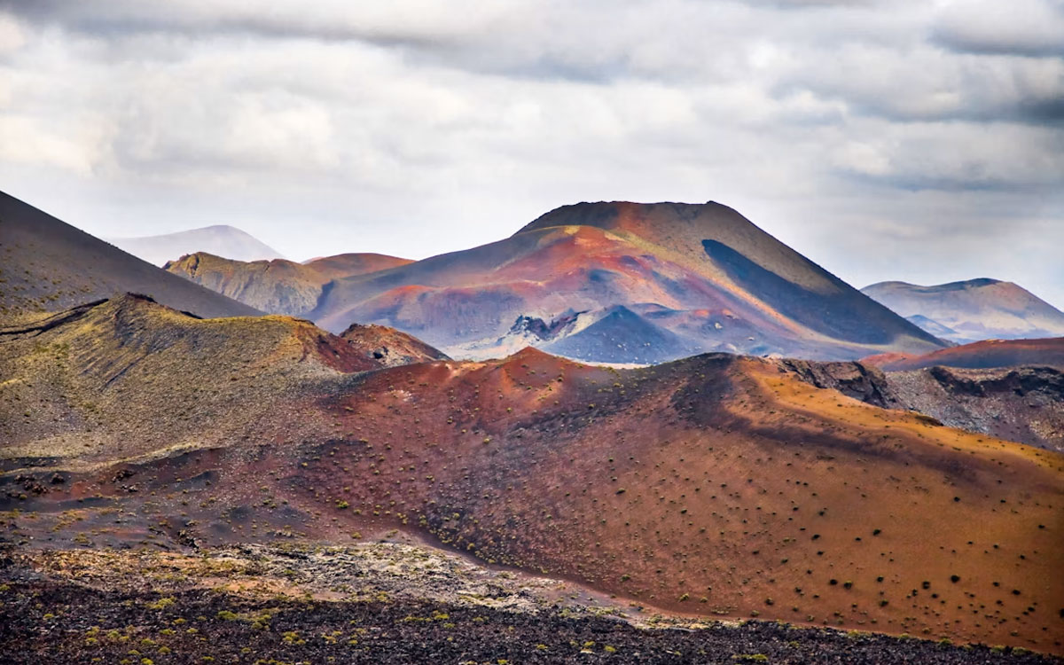
Lanzarote volcano hikes beyond Timanfaya
Travellers who want to walk among craters and lava fields can find several Lanzarote volcano hikes beyond Timanfaya’s conventional visitor route. Caldera Blanca, Volcán del Cuervo and Montaña Colorada offer close contact with the island’s geology, but these volcanic landscapes do not all have the same rules or level of difficulty.
Timanfaya National Park protects an extremely fragile area where unrestricted walking is not permitted. The neighbouring Los Volcanes Natural Park contains several marked paths that can be explored independently, provided visitors remain on authorised trails.
On the First Minute Excursions and Last Minute Transfer blog, we want to make this distinction clear so that an apparently simple walk does not lead into a restricted area.
Timanfaya and Los Volcanes are different protected areas
The continuous volcanic scenery can make the two parks appear to be a single space. However, they are separate protected areas with different access conditions.
Timanfaya National Park preserves much of the territory transformed by the eighteenth- and nineteenth-century eruptions. Visitors cannot freely walk away from authorised roads, facilities and designated paths.
Los Volcanes Natural Park surrounds part of the national park and includes marked trails around Volcán del Cuervo, Montaña Colorada and Caldera Blanca.
A marked route does not give visitors permission to climb every slope or cross the lava fields. Loose volcanic material erodes easily, while lichens and other vegetation can take a very long time to recover.
Our overview of Lanzarote’s protected landscapes provides further context about these neighbouring natural areas.
Volcán del Cuervo: an accessible introduction
Volcán del Cuervo, also known as Caldera de los Cuervos, is one of the most approachable walks for travellers who want to experience a volcanic crater.
The marked trail begins beside the LZ-56 road. It circles the cone and enters the crater through the authorised opening. The walk is relatively short and has little technical difficulty.
The route reveals different types of lava, ash and volcanic material. This cone was one of the first eruptive centres in the major sequence that began in 1730 and transformed a large part of Lanzarote.
Its accessibility does not make off-trail walking acceptable. Informal tracks damage loose ground and encourage later visitors to follow the same route.
It can suit families who are comfortable walking, first-time hikers and visitors looking for a manageable introduction to Lanzarote’s volcanic landscape.
Montaña Colorada: volcanic colour and lava bombs
Montaña Colorada stands opposite Volcán del Cuervo, on the other side of the road. Its circular path reveals red, black and ochre tones that can change noticeably according to the light.
The area is also known for its volcanic bombs. These are pieces of material projected during an eruption and shaped as they travelled through the air or landed on the ground.
The trail is generally considered easy, although loose surfaces, sunshine and strong wind may make it feel more demanding. Visitors should not climb on the volcanic bombs, move stones or remove geological material.
Volcán del Cuervo and Montaña Colorada can be walked separately. Creating an unofficial shortcut between the two routes risks crossing areas that are not open to walkers.
Caldera Blanca: a longer volcanic route
Caldera Blanca requires more time and preparation. The route begins near Mancha Blanca and crosses a wide expanse of lava before reaching one of Lanzarote’s largest craters.
The complete official itinerary is around 16 kilometres and is classified as a medium-difficulty walk. It requires sufficient water, sun protection, suitable footwear and a reasonable level of fitness.
Its pale, older volcanic structure contrasts sharply with the dark lava flows surrounding it. Higher sections provide broad views across Los Volcanes Natural Park and towards Timanfaya.
Caldera Blanca should not be treated as a quick sightseeing stop. There is almost no shade, the surface is irregular and wind conditions can become uncomfortable near exposed sections of the crater.
Timanfaya’s coastal trail: open but demanding
One route inside Timanfaya National Park can be walked independently without a guide or permit: the coastal path.
This linear trail crosses a coastline formed by lava flows, cliffs and volcanic beaches. Different sections are possible, while the longer route between Playa de la Madera and El Golfo is close to ten kilometres.
It is not an easy substitute for the conventional Timanfaya visit. The ground is rough, mobile coverage is absent in places and rescue access is only possible on foot.
Heat, exposure, sea conditions and the lack of shade must all be considered. This route is most appropriate for experienced walkers with boots, sufficient water and a clear plan for returning from a linear hike.
Which volcanic walk should you choose?
The main Lanzarote volcano hikes suit different visitors:
- Volcán del Cuervo for a short introductory walk.
- Montaña Colorada for volcanic colours and geological features.
- Caldera Blanca for a longer and more demanding day.
- Timanfaya’s coastal trail for experienced hikers.
- The standard Timanfaya visit for seeing the Fire Mountains without unrestricted walking.
Distance is not the only factor. Consider the surface, wind, sun exposure, fitness and experience of every person in the group.
Our guide to visiting Timanfaya without rushing explains how the organised national park experience differs from these independent walks.
How to protect Lanzarote’s volcanic landscape
Volcanic rock may appear solid, but loose ash and lapilli can be displaced very easily. Lichens and small plants also grow extremely slowly in these conditions.
Responsible walking means:
- remaining on the marked path;
- never building stone piles;
- taking no rocks or plants;
- leaving no drawings or marks;
- carrying all rubbish away;
- respecting drone restrictions;
- using designated parking areas;
- avoiding the hottest part of the day.
The best trace a walker can leave is no trace at all. Turning back is also the correct decision when wind, heat or visibility make the route unsafe.
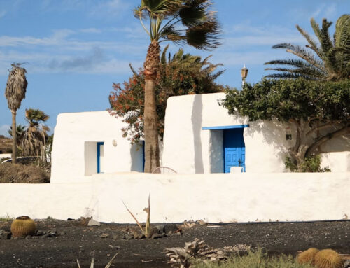
The landscape surrounding Tinajo shows how villages, crops and volcanic terrain coexist in this part of the island.
A different way to understand volcanic Lanzarote
Walking these Lanzarote volcano hikes reveals the island at a slower and more detailed scale. Visitors can cross old lava flows, recognise different cones and understand how eruptions changed roads, farmland and settlements.
Volcán del Cuervo offers an accessible introduction, Montaña Colorada adds geological variety, Caldera Blanca requires more endurance and Timanfaya’s coastal trail provides a remote challenge.
The aim is not to reach every crater. Choosing a suitable route, respecting restrictions and protecting the ground are essential parts of the experience.


Leave A Comment